Five-Orbit
Lot Capture
Circle the future home site five times, top to bottom. The drone shoots a photo every 2 seconds the whole way around. High orbits sell the setting; low orbits sell the lot.
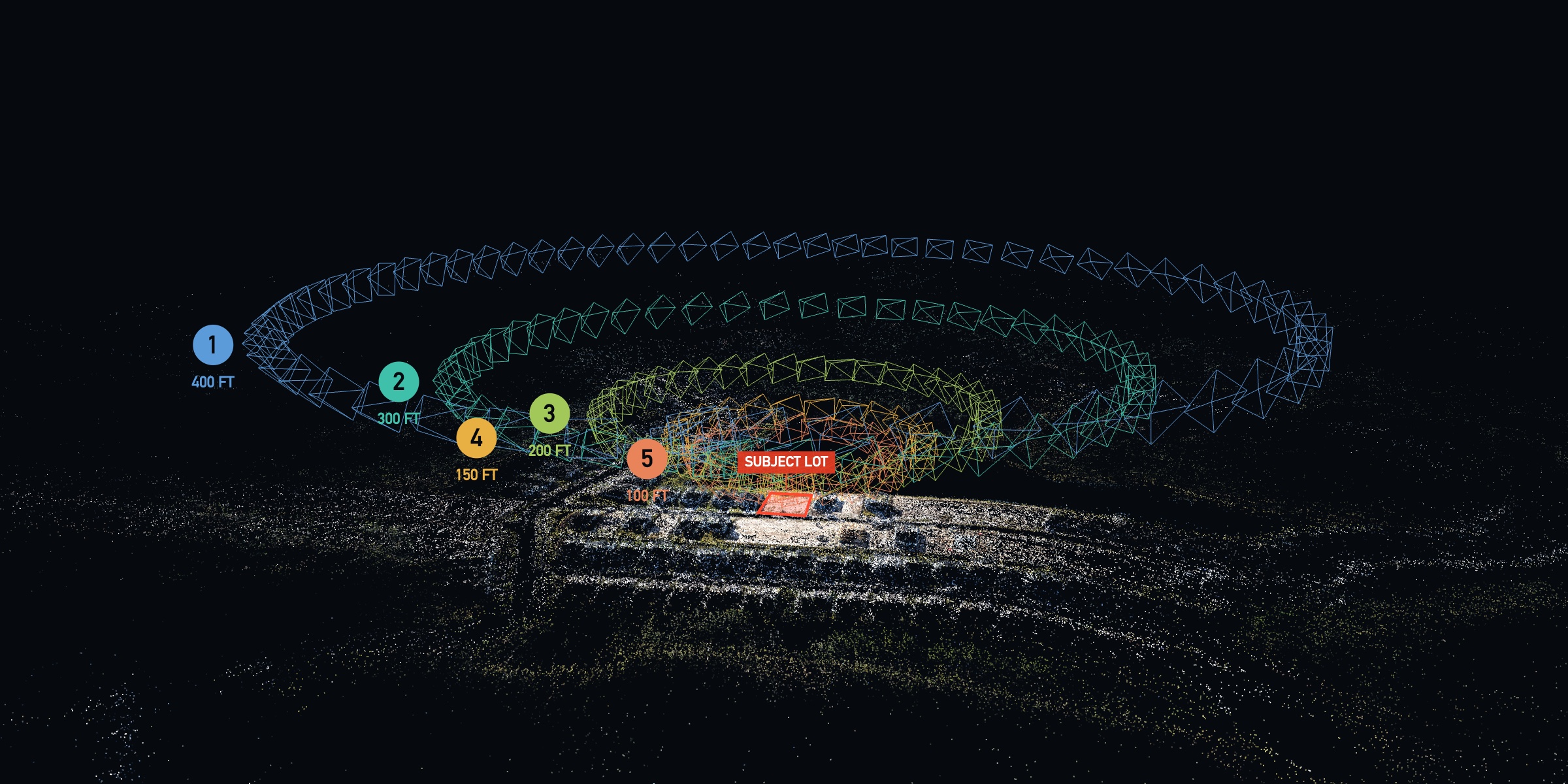
The real mission, reconstructed — every pyramid is one photo position. Five numbered orbits, each lower, tighter and steeper than the last, circling the subject lot (outlined in red).
−10 to −14° 300FT The street scene Thin band of sky at the top edge 575–700 ft
−15 to −19° 200FT The lot in context No sky; lot centered in frame 340–420 ft
−24 to −28° 150FT Lot detail No sky; lot fills the frame 220–280 ft
−27 to −31° 100FT The buyer's-eye view Sliver of sky or tree line at the very top 170–220 ft
−17 to −21°
Fly the ladder top-down: 400 → 300 → 200 → 150 → 100 ft. Shoot on a 2-second interval; pause the camera between orbits while you descend and reset. Fly smooth, unhurried laps — slower is better down low.
The gimbal does two jobs: framing the story and feeding the splat. A splat needs the same ground seen from many different angles — shallow up high, steep in the middle, shallow again down low. That spread is what makes the model solid from every viewpoint.
400 FTThe setting
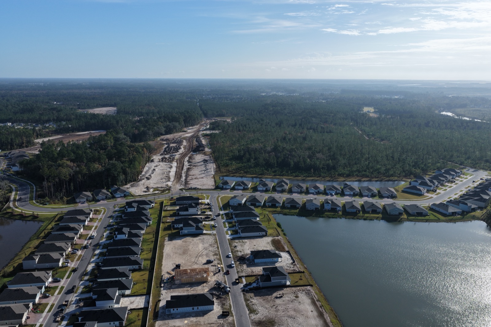
Shallow gimbal. The center of frame aims past the lot at the far surroundings — this is the context layer. The lot stays small, three-quarters down the frame, and the views do the talking.
300 FTThe street scene
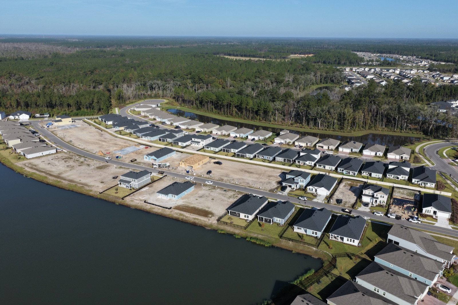
Still shallow. Streets, rooftops and amenities fill the frame, with the lot two-thirds of the way down. Keep just a thin strip of sky — this orbit places the lot in its neighborhood.
200 FTThe lot in context
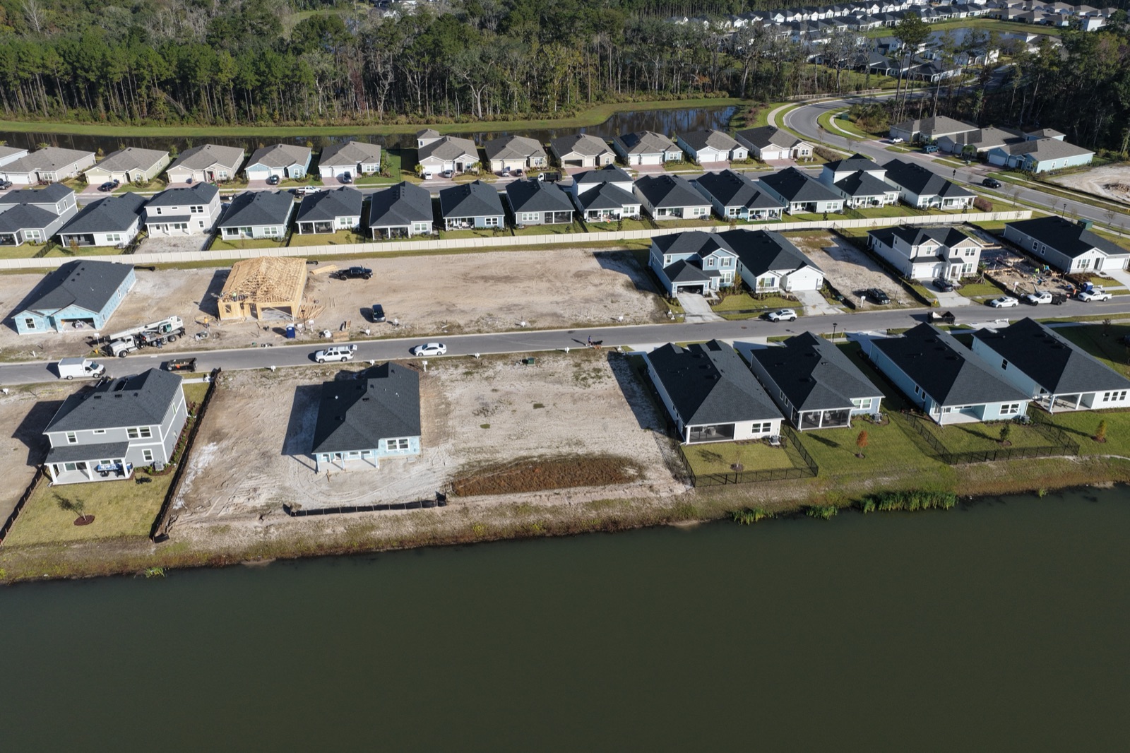
Steep. Aim at the lot itself — no sky anywhere in frame. From this orbit down you are feeding ground detail into the model; this is where it gets its substance.
150 FTLot detail
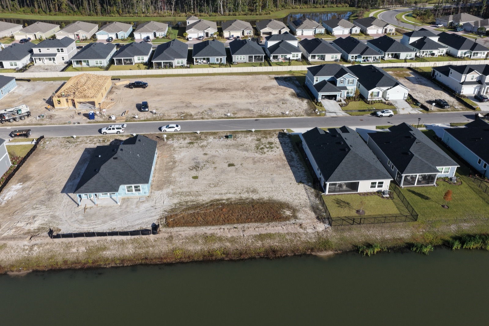
Steepest gimbal of the mission. The lot fills the middle of the frame: property lines, grading and ground texture, seen from every side of the circle.
100 FTThe buyer's-eye view
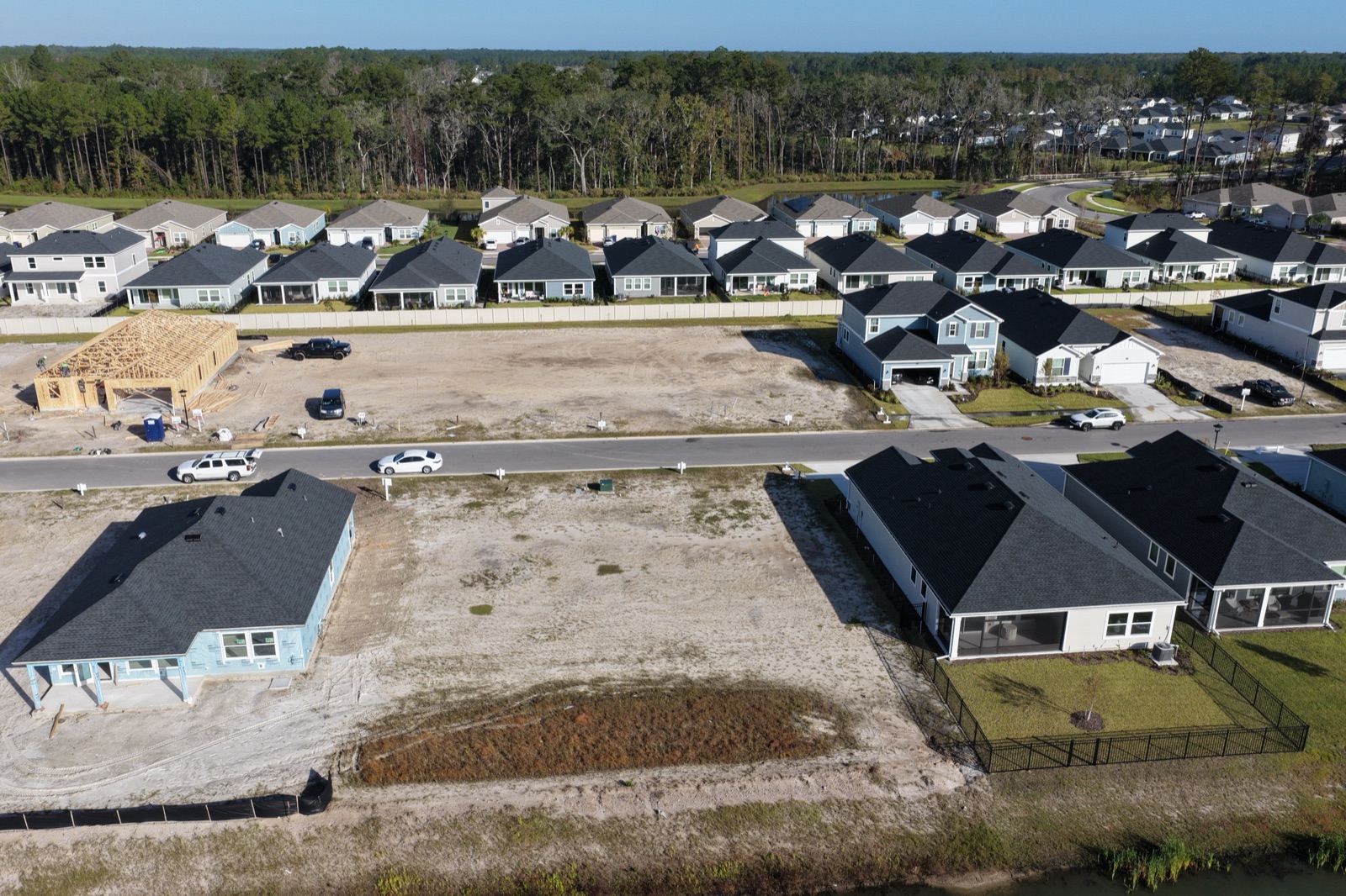
Back off the gimbal — you're looking across the lot, not down at it. These near-eye-level frames become the views a buyer sees standing on their future porch; a steep angle here would just photograph dirt.